Hiking and Biking
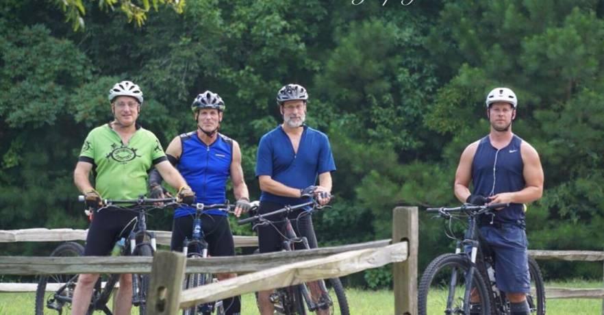
Photo Credit: Dana Dobbins Photography
Pictured: Volunteers from the Mountain Lakes Cycling Club.
Click here to download a map of our hiking and biking trails. For more information, contact us at (256) 571-5455.
The trails at Lake Guntersville State Park encompass more than 36 miles of varied terrain, ranging from moderate to difficult, and are suitable for hiking and biking. Our trails can lead you through picturesque landscapes along the banks of the Tennessee River, while others showcase seasonal waterfalls and vibrant wildflowers. Some will pique your interest simply because of their name. Whether you're looking for a 30-minute stroll or a day of exploration, we have something for everyone!
Additional Information
- Trail lengths are one-way mileage, not round-trip.
- Trail marker colors are noted.
- Where mentioned, the "park road" is the loop of roads located off Highway 227 at the entrance to the park that leads to the cottages, campground, chalets, golf course, and Lodge.
Benny Bobo Accessible Trail (Orange, 0.3 miles) - Paved trail that starts at Mabrey’s Overlook in front of the Golf Course and Lodge. Trailhead parking is at the Lodge or Golf Course. One handicap parking space is available at Mabrey’s Overlook.
Bootlegger Trail (Red, 2.5 miles) - Starts across from the parking lot located at the front entrance to the park, behind the “Watch for Wildlife” sign. The park’s newest trail follows the 600 contour line all the way to Town Creek. It features slight rolling climbs and crosses some ravines with bridges. Shaded with a wide variety of trees and wildlife. Trailhead parking is available in the front parking lot at the park entrance, before the front guard shack, or at the Town Creek Bridge.
Butler's Pass (Blue, 1.2 miles) - Elevation at the top is 1,050. Butler’s Pass is a rocky trail that traverses the mountain, with its endpoints at the top being the intersection of Dry Falls/Golf Course/Nature Trail, and on the bottom, Moonshine, King’s Chapel, and the Terrell Connector. Butler’s Pass has some rocky sections, but overall it is moderate and features fast, fun sections. There is a beautiful scenic overlook with a bench, too! Trailhead Parking is available at the Lodge, the picnic area off Lodge Road, and at limited roadside locations.
Cascade Trail (Blue, 0.8 miles, Hiking only) - This path is moderate. Access to this trail is gained just inside the park's entrance at the 35 mph sign, as well as on the back side of the Nature Trail across from the Lodge. This path follows a natural watershed with large boulders, pools of water, cliffs, and wild azaleas, and offers marvelous views from the trail's edge. The trail links up with the Old Still Path, Old Meredith Trail, Unnamed Trail, Golf Course Loop, and Taylor Mountain Trail. Trailhead parking is located in the front parking lot near the park entrance, accessible via the Terrell Connector, walking on Aubrey Carr Scenic Drive, or limited roadside parking at the 35 mph sign.
Cave Trail (Red, 1.5 miles) - A 1-mile ascent with an elevation gain of approximately 100 feet. Some short sections have a max grade of greater than 20%. This trail ends at the Tom Bevill Trail and is an easy hike/moderate bike ride. Start across the paved park road from the cave itself to take the Cave Trail up the mountain to Tom Bevill.
Cave Alternate Trail (0.6 miles) - This trail is rocky, featuring a 225-foot elevation change. Some sections have a max grade drop of 20% or greater. If starting from the top, at the intersection with Moonshine, you can descend the mountain, visit the small cave, and cross the main park road to take the Cave Trail, which leads up to Ellenburg Mountain and connects to the Tom Bevill Trail. Trailhead parking is located at the small gravel pullover before you come to the Lakeside Cabins.
Chalet (Orange, 0.3 miles) - This trail starts behind the Chalets on top of the mountain and drops down onto Loop Trail, which connects to either the Lodge, the Cave, or across the park road to Butler’s and Moonshine Trails. Trailhead parking is located at the lodge, accessible through the Chalet parking area.
Cutchenmine Trail (Blue - 3.1 miles) - Primarily a double track, with a solid base and moderate terrain. There are several climbs, but the effort is worth it! Enjoy the beautiful, rocky creek at the back of this trail and its wildflowers in the spring. Trailhead parking is located at the Short Creek Boat Ramp parking lot.
Daniel's Trail (White, 0.5 miles) - Feel surrounded by nature with the large trees, boulders, and occasional glimpses of deer on this easy path. Trailhead parking is located at the Campground Store and is accessible only by taking either the Lickskillet or Lodge Trail.
Dry Falls Trail (Green, 0.8 miles) - With an elevation at the top of 1,050 ft. and at the bottom 700 ft, this trail is the shortest route up and down the mountain. This trail is steep and rocky in many sections, making it a challenge to ride up for most, but fast and fun on the way down (though still technical in some areas). Dry Falls' endpoints are at the gravel parking lot where it intersects with Terrell Connector Trail, the bottom of Moonshine Trail, and the bottom of King’s Chapel Trail on one end, and at the Lodge on the other end. Trailhead parking is located at the park entrance. Turn left after the guard shack, and then proceed to the first gravel parking lot, which is situated off Aubrey Carr Scenic Drive on the right.
Golf Course Loop (Yellow, 3.8 miles) - The Golf Course Loop is a 3.8-mile loop that includes a short section (approximately 0.25 miles) on the main park road located between the lodge and the golf course parking lot and crosses the main park road twice. This trail provides a creek crossing and some of the best views of beautiful Lake Guntersville! This trail is almost entirely double-track width and has a fun, flowing terrain. It's an excellent trail for beginners. Trailhead parking is at the Lodge or the Golf Course.
Graveyard Road (White, 0.2 miles) - Service road access to King’s Chapel Cemetery and can also be used to access the Tom Bevill Trail.
King's Chapel Trail (Red, 0.8 miles) - This intriguing trail leads to an old cemetery located inside the boundaries of Guntersville State Park. This path is moderate to difficult. Feel free to either return the way you came or make a loop back by taking Terrell Trail. Trailhead parking is located at the park entrance. Turn left after the guard shack, and then proceed to the first gravel parking lot, which is situated off Aubrey Carr Scenic Drive on the right.
Lickskillet Trail (Orange, 2.7 miles) - This trail connects the campground to Town Creek and follows an old path dating back to the early 1800s when Cherokee Indians inhabited the region. The trail emerges onto Highway 227 just before the Town Creek Bridge, crossing both the main park road and a service road. Large beech trees, spring wildflowers, and beautiful fall foliage make this trail a treat year-round. Add mileage to this trail by taking a loop from the campground to Meredith Trail, to Seale’s Trail, and winding back up in the campground, for a total of 4 miles. This path is Moderate. Trailhead parking is at the Campground, off Aubrey Carr Scenic Drive near the Pump Service Road parking area, or at the Town Creek Bridge.
Lodge Trail (Red, 0.8 miles, Hiking only) - If at the Lodge, this trail begins at the Lodge's playground next to the Zipline building and descends to the Campground. If at the Campground, this trail starts directly across from the Campground store. Deer are often seen along this trail. This path is moderate. Trailhead parking is at the Lodge or at the Campground Store.
Loop Trail (Blue, 1.4 miles) - This trail starts off of Lodge Trail and follows the 750 contour line along the bottom of the mountain below the Lodge. It briefly joins Cave Trail and turns back underneath the Chalets to join Lodge Trail. Great views of the lake in the winter and many deer in the summer. Trailhead parking is at the Campground Store or at the Lodge.
Meredith Trail (Green, 0.8 miles) - Extending from the Golf Course Loop to the Town Creek Bridge and intersecting with the Lickskillet Trail, this path crosses a rocky stream and skirts the outer regions of the golf course. This path is moderate to difficult. Trailhead parking is at Town Creek Bridge.
Moonshine Trail (Orange, 0.8 miles) - This moderate trail stretches from one end of Butler’s Pass to the gravel parking lot at the intersection of Dry Falls/King’s Chapel/Terrell Connector. For biking, it is a fast and easy trail with a few technical sections. Trailhead parking is available at the entrance to the park, where you should turn left after passing the guard shack. Additionally, parking is available at the first gravel lot on the right side of Aubrey Carr Scenic Drive.
Nature Trail (Red, 0.5 miles) - This easy trail is located on the mountain directly across from the Lodge. It has access to the Cascade, Golf Course Loop, and Dry Falls Trails near the back of this trail. This is an excellent path for park guests to take a leisurely walk after enjoying a delightful meal at the Lodge. Trailhead parking is at the Lodge.
Old Lickskillet Trail (White, 0.6 miles, Hiking only) - This trail may be entered at the park road above the Campground, and on the park road at the top of the hill. This path is moderate to difficult. Trailhead parking is limited to roadside parking or at the Campground.
Old Still Path (Orange, 0.7 miles, Hiking only) - This short and easy trail connects the Dry Falls Trail with the Cascade Trail. It passes an old whiskey still that was on the land before it became a State Park. You can still see some of the revenuers' axe marks in the remains, although nature is slowly reclaiming this area. Trailhead parking is located at the park entrance. Turn left after the guard shack, and then proceed to the first gravel parking lot, which is situated off Aubrey Carr Scenic Drive on the right.
Seale's Trail (Blue, 1.6 miles, Hiking only) - This easy trail follows Town Creek from the bridge at Highway 227 to the Campground. A vast array of maple, hickory, and beech trees offers gorgeous fall color and is named for Rex and Ruth Seale, a couple who worked tirelessly to build, mark, and maintain our extensive trail system. Trailhead parking is at the Town Creek Bridge or within the primitive camping area at the Campground.
Shannon Trail (Blue, 0.3 miles, Hiking only) - This is a short, easy connector trail between Old Lickskillet and Lickskillet. Trailhead parking is at the campground or at the Lickskillet parking areas.
Spring Trail (Unmarked, off Tom Bevill Trail, 0.25 miles, Hiking only) - Featuring a spring that flows year-round, this easy-to-moderate path connects two legs of the Tom Bevill Trail and passes by a once vital source of water for Cherokee Indians.
Taylor Mountain Trail (Green, 1.9 miles) - The Taylor Mountain Trail has an elevation change of approximately 300 feet. Some sections have a max trail grade of 15% or greater. Taylor Mountain Trail is joined by the Terrell Connector Trail at the bottom and the Golf Course Trail at the top. There are some loose rocks and technical areas on this trail, including switchbacks. Trailhead parking is located at the entrance to the park, where you turn left at the guard shack. You may also park at the gravel parking lot off Aubrey Carr Scenic Drive.
Terrell Connector Trail (Yellow, 0.2 miles) - As its name suggests, this trail connects several trails and features wooden bridges to cross. Trailhead parking is at the park entrance.
Tom Bevill Trail (Orange, 3.9 miles) - The Tom Bevill Trail is a 3.9-mile loop that circumnavigates Ellenburg Mountain. There are some challenging climbs, switchbacks, and great views. This is a moderate trail for hikers and bikers. You will encounter several roots and technical areas, but enjoy a great downhill on the back side of the mountain, descending to the intersection with Cave Trail. Trailhead parking is located at the Short Creek Boat Ramp parking lot.
Trail of Tears (Green, 0.6 miles) - Located at the free day-use area boat ramp, this short, flat hike retraces a section of the original Trail of Tears route.
Unnamed Trail (Yellow, 0.5 miles) - Connects Old Meredith and Taylor Mountain Trails.
Town Creek Horse Trails
Our horse trails are located near our Town Creek Campground and offer miles of moderate-to-rugged terrain. Primitive camping is permitted near the trailhead and at Town Creek. For more information about our horseback riding trails, click here.